x»Shipping 4.0«, »Smart Shipping« and »Big Data« – all in all buzzwords in maritime discussions these days. Digitized services are said to add efficiency, improve transportation and reduce cost. The potential for navigation systems is huge
In the past, navigators have often complained about too much and inconsistent information on the bridge, a poor presentation of[ds_preview] data as well as a higher level of stress – all impacting the risk of accident due to human factors.
E-navigation – which is the digitalization related to the bridge navigation systems – aims for better integration and harmonization of bridge systems, for a consistent presentation of data, and for better use of data communications between the participants in global shipping. The benefits of e-navigation, ship-to-ship and ship-to-shore connections as well as cooperative shipping are still subject to investigation in various international research projects.
It becomes quite clear that it is not all about the »autonomous cyber ship« but about improving existing systems by making use of modern technologies, data structures and communication links. E-navigation is about innovating smart sensors, functions and services across onboard navigation and communication systems, which aim for lean operation, reduced workload and – together with other means of »Shipping 4.0« – improved efficiency through the entire value chain in global shipping.
The basis for all the improvement of the modern bridge is integration, building on uniform and consistently developed system- and operator-concepts, modern and secure network structures and harmonized data exchange.
A first major step toward harmonization and ergonomics was the new performance standard for Integrated Navigation Systems (INS) MSC.252(83). The new INS standard relieved the navigator considerably and contributed to a better situation awareness. The next step was the harmonization of presentation of alerts in the Bridge Alert Management MSC.303(87).
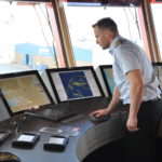
Modern bridge systems, moreover, follow a holistic system concept, with all sensor data, charts and radar video made available for navigation in a local area network (LAN). Multifunction consoles enable access to applications such as radar or ECDIS from every workplace. Thereby the availability of data in the network not only improves the navigation system. Data can be processed in a new context – different than in the classic applications such as radar or ECDIS – to not only offer another display with information but decision support related to a specific situation or task. This also includes the integration of additional sensors or even camera systems. Such displays for decision support and situation analysis – situation overviews – play an important role in current research.
Besides the INS standards and the modern navigation networks, a number of further innovations is introduced, which can be related to Navigation 4.0.
Next generation smart sensors
Complex sensor interfacing, poor flexibility in system layout and installation or even inappropriate redundancy and performance losses – all that belongs to the past. Heading and radar sensors are most critical in the network. And these sensors start sharing their data and status information via Ethernet. This not only simplifies and improves system integration; it makes sensor information also flexible for use by further (third-party) applications. Processing is done by the respective end-user application – for example, an ice radar or a radar for sea space surveillance does not need to use the pre-processed data of a navigational radar but can take the best out of the raw video.
But being smart is not limited to system integration. Sensors can today report their health status to operators. New radars, for example, are available which offer automated continuous performance monitoring. These radars regularly report the Magnetron condition and provide a warning to the operator when maintenance is required. The same can happen with gyro compasses and the condition of the gyrosphere. Maintenance can thus be planned in good time in advance to avoid delays or service surcharges.
When looking at efficiency and cost reduction in shipping, just-in-time arrivals and departures are of key importance. Current research on integrated route planning, under the participation of additional stakeholders such as container terminal operators or coastal surveillance authorities and with a stronger focus on speed and arrival planning, is expected to deliver results which will be
of high interest for ship owners and operators.
But also smart service and maintenance is important to operate on schedule. Navigation system manufacturers are launching service tools, which enable the remote access to system files and configuration data. Data and failure analysis, as well as check-ups of system condition and configuration allows an early diagnosis, maintenance warnings or preventive actions. The benefits for shipowners and operators: less unforeseen services, an optimized planning of service attendance and spare part availability, higher first time fix rates, fast service on board, reduced cost.
Online weather charts
ECDIS already offers a number of features related to e-navigation. For example, digital chart updates including temporarily and preliminarily notices to mariners (T&P NtM) have proven to reduce workload a lot and at the same time to increase safety by making sure that always updated charts are in use.
As Navigation 4.0 is closely related to efficiency and cost reduction, an important issue is consideration of weather impact on route planning. The IMO has calculated that good weather routing can reduce the fuel consumption by about 2–4% per year. The easiest way to use weather information during route planning is to overlay the sea chart with a weather chart. This shows the planned route and the forecast weather situation – with all the important weather and sea condition data – at a glance. The data can be transmitted via SatCom directly into the electronic sea chart, or alternatively the data can be transferred by a USB stick.
It can be expected that the focus on ECDIS – and in particular with regard to a »Smart Data Sharing« between ships (collision avoidance) and ship and shore (optimized route and cargo planning) – in international research projects will lead to additional features. Furthermore, coastal states in many countries are currently working out concepts for such coastal services, called Maritime Service Portfolios (MSP). Information will also flow from ships to shore, to enable coastal stations and commercial agents to monitor the ships online; this includes for example automated ship position reporting and even exchange of cargo stowage plans.
The basis for all the improvement of the modern bridge is integration with modern network structures and harmonized data exchange. The integrated navigation system with its multifunction consoles is therefore a solid platform – and it is virtually the entrance ticket to the current and future benefits related to »Shipping 4.0«.
Martin Richter


